From microstructural observations of seismically-liquefied lacustrine tephra layers to the spatio-temporal distributions of palaeo-earthquakes and their intensities and potential hazards
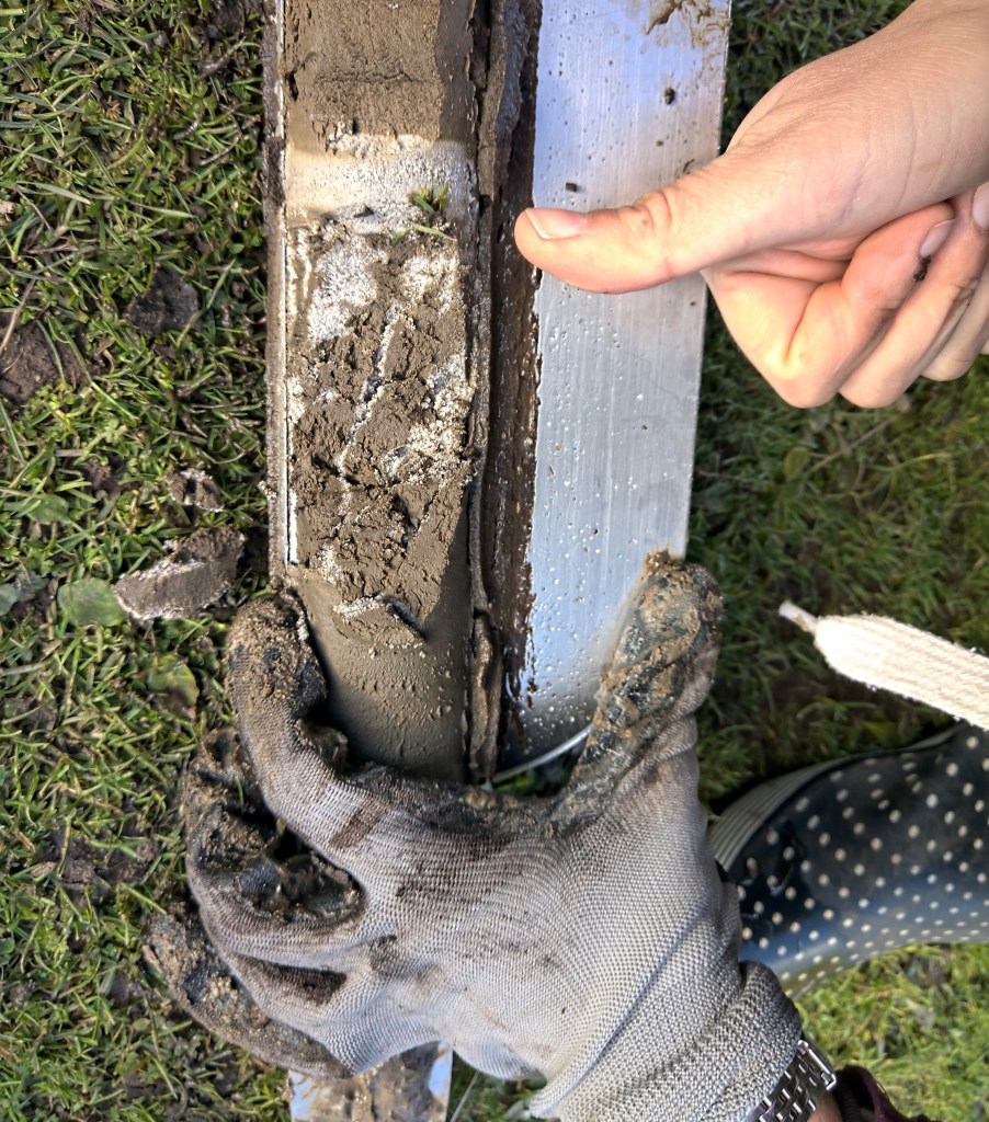
Liquefaction in Rotorua tephra – core from Rotoroa/Hamilton Lake
Our latest paper in Science Advances, led by Dr Max Kluger, brings together the key findings from the Tephra Seismites project.
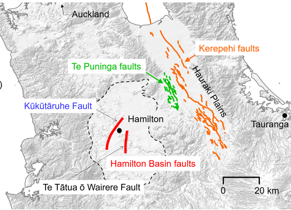
Using cores from 18 lakes and using CT imaging, we looked at how the sizes and numbers of tephra seismites (liquefaction features in the volcanic ash) changed across the Hamilton Basin.
From this, we could infer that the liquefaction features were linked to five major earthquakes on Te Puninga and/or Kerepehi faults in Hauraki Basin, the newly discovered Kūkūtāruhe Fault in central Hamilton Basin, and either an unknown, hidden fault in the southeastern part of Hamilton Basin (near Te Awamutu) or an unmapped southern extension of Te Tātua ō Wairere Fault in the east-central Hamilton Basin.
Using the ages of the volcanic ash layers, we were also able to estimate dates for the earthquake events. Finally, using a process called seismic modelling we confirmed which faults had ruptured and estimated the magnitudes (Mw) of each rupture (earthquake). Three of the earthquakes were magnitude 7.0 Mw or greater.
Hidden liquefaction features in thin tephra layers, revealed only by the CT scanning, show that two of these past earthquakes were within the last 1700 years.
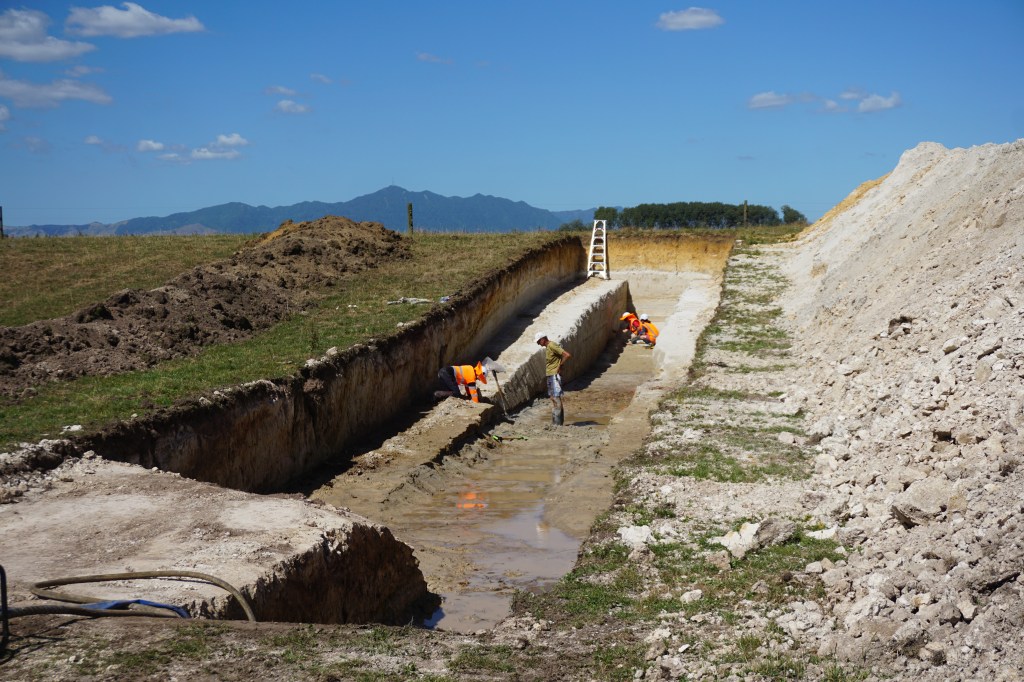
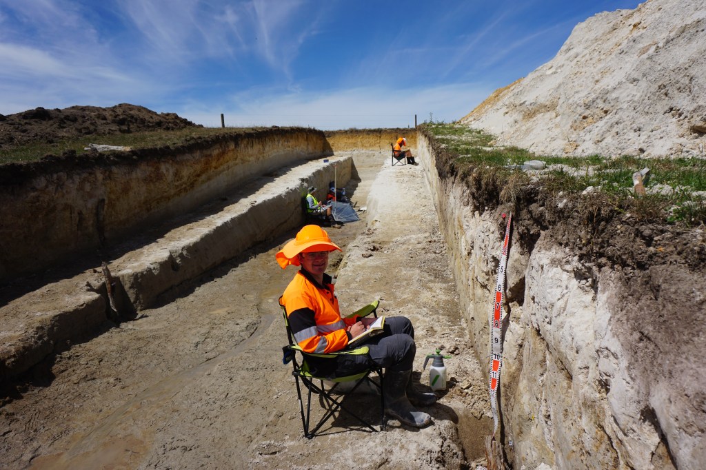
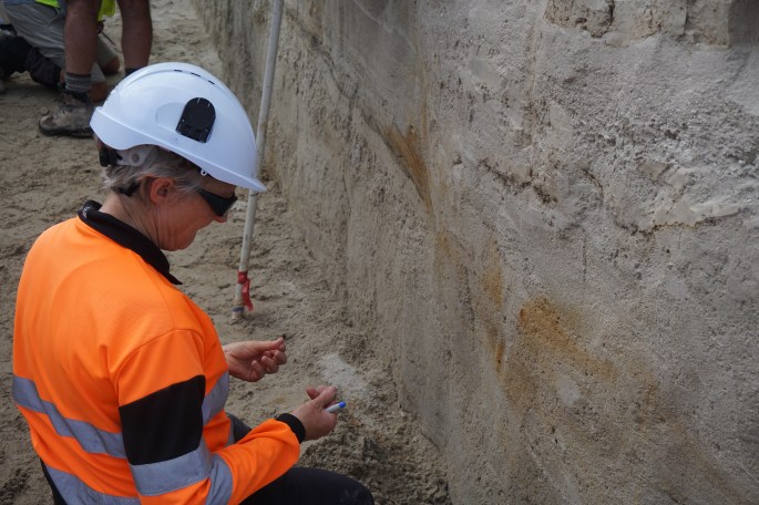
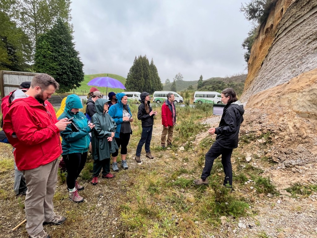
Hard on the heels of the paper published in January 2024 in the New Zealand Journal of Geology and Geophysics, members of the tephra seismites team joined GNS Science colleagues to renew their research on the Te Puninga Fault at two newly dug trenches across the fault (which is near Morrinsville) in late February 2024.
The excavations and field analyses of the deposits in the freshly exposed trench walls (see photos) were supervised by Dr Genevieve Coffey of GNS Science with support from GNS colleagues and also some geoscience staff from University of Auckland and University of Canterbury as well as University of Waikato.
The research on the fault is part of a joint project involving funding from the Marsden Fund provided to the University of Waikato (supporting the tephra seismites project) and from Toka Tū Ake EQC to GNS Science.
The Te Puninga Fault is important for the tephra seismites project because it is the closest fault to the north-eastern part of the Hamilton Basin, the focus of the project centred on liquefied tephra layers preserved in numerous lakes in the basin.
The trenching-based research on Te Puninga Fault represents the last phase of field work to be undertaken under the banner of the Marsden-funded tephra seismites project, which finished at the end of February 2024.
Various analyses and interpretations of arising from detailed examination and sampling of deposits exposed in the trench walls (at both sites) will continue through the year.
View of freshly excavated trench, up to 3 m deep, straddling Te Puninga Fault. The location is on a farm on Quine Rd near Morrinsville (February 2024). View looking west. Photo: D.J. LoweDr Vicki Moon (University of Waikato) and Dr Genevieve Coffey (GNS Science) in foreground examining soil and geological materials in the lower part of the trench. Photo: D.J. Lowe
We are pleased to advise that we have in the past few weeks (January 2024) published an open access paper in the New Zealand Journal of Geology and Geophysics on our findings from research undertaken on the recently discovered Te Puninga Fault near Morrinsville. The paper is available here:
The article is based on analyses of two trenches excavated across the fault in February 2022 (see photos). The purpose of the work was to examine the possible size and frequency of earthquakes on the fault, which would potentially have had an impact on the lakes and associated liquefied lacustrine tephras we are investigating in the adjacent Hamilton lowlands.
Trench newly dug across Te Puninga Fault in February 2022. Mt Te Aroha is just visible on the skyline in the background. Photo: D.J. LoweJosh Hughes in the trench describing the exposed geological deposits.Dr Vicki Moon examining alluvial sediments in the trench. Josh later completed his masterate thesis (2023) on aspects of the Te Puninga Fault research (https://researchcommons.waikato.ac.nz/handle/10289/16007). Photos: D.J. Lowe
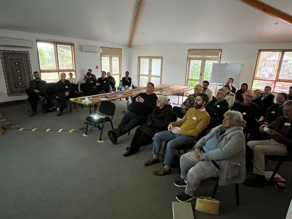
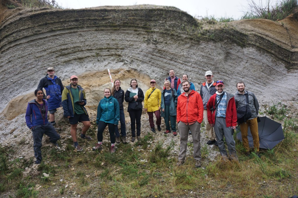
The Tephra Seismites group ran a very successful hui, entitled ‘Our earth-shaking discoveries so far!’, for our supporters, mana whenua partners, and stakeholders, on Tuesday 25 July 2023.
After an introduction to the project, we began with a workshop, ‘Core blimey!’ where we laid out opened lake cores, and had a discussion about the significance of lake sediment cores and the tephra beds inside them.
David explaining lake sediment cores
On display were a long set of cores from Lake Pikopiko that showed numerous tephra layers, spanning eruptions that occurred 2800 to 17500 years ago, while cores from Rotoroa (Hamilton Lake) and Wairotoiti/Ngārotoiti gave examples of the tephra and alluvial sediment liquefaction features we have been studying.
Cores: top left, Wairotoiti/Ngārotoiti; bottom left, Rotoroa/Hamilton Lake; right, Pikopiko. Coloured labels give the tephra names; ‘Alluvium’ is river-derived sediment; the numbers on the right give the tephra/sediment age in thousands of years.
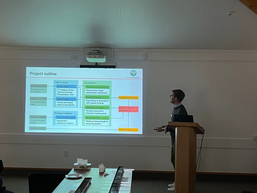
We had seven talks from the main research group members. Dr Max Kluger led with ‘Towards understanding seismic hazard in the Hamilton Basin’, an overview of the entire project and key findings to date.
Max giving a comprehensive overview of the Tephra Seismites project
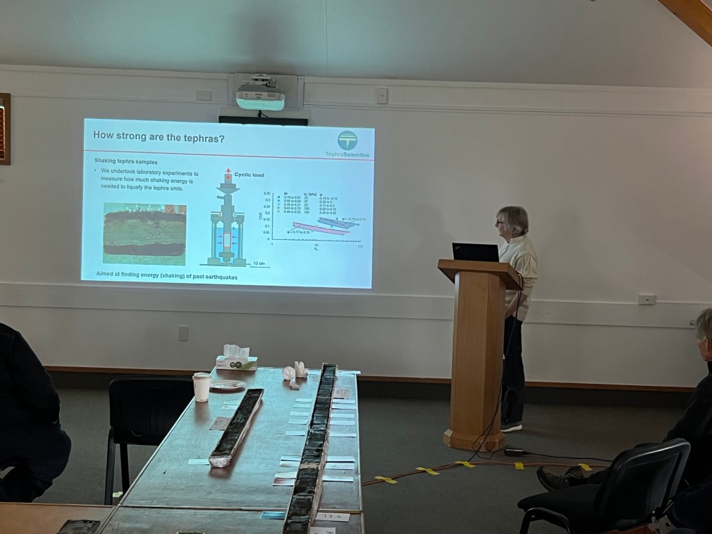
Five shorter talks that followed focused on different areas of the project: ‘Cores on a fine scale: using CT scans to understand lake sediments’ (Dr Tehnuka Ilanko); ‘Messing about in boats: investigating distribution of liquefaction features in lake sediments using ground-penetrating radar’ (Richard Melchert); ‘Our precious lakes’ (Prof. David Lowe); ‘Not our fault: Te Puninga Fault near Morrinsville’ (Josh Hughes); ‘Using laboratory liquefaction testing to estimate past earthquake shaking’ (Jordanka Chaneva). We wrapped up with a summary and an idea of next steps towards modelling past earthquake shaking from Dr Vicki Moon.
Vicki giving a summary to close the session
Many thanks to mana whenua representatives from Ngāti Wairere and Ngā Iwi Toopu O Waipa, and all who attended – we are grateful for your support and interest.
Attendees at ‘Our earth-shaking discoveries so far!’
Our latest update on research progress was emailed to partners, supporters and stakeholders, and can be viewed below. It includes an invitation to a meeting/hui, on the morning of 25 July 2023, to discuss our project and findings to date. For further details, please see page 1 of the newsletter and contact us.
This paper is based on her lab work, testing the properties of Tuhua tephra (one of the younger tephra layers in our study). In addition to contributing more broadly to understanding the undrained behaviour and liquefaction resistance of similar soils (pumiceous silts), Jordanka’s work helps us understand the response of Tuhua tephra in the Hamilton Basin lakes to earthquake shaking, by analysing its liquefaction potential.
Many thanks to Ngāti Wairere and the Department of Conservation for field site access, and to MBIE, Marsden, QuakeCoRE, EQC, and Waikato Regional Council for funding.
Two weeks ago, some of the Tephra Seismites group attended the IAVCEI (International Association of Volcanology and Chemistry of the Earth’s Interior) 2023 Scientific Assembly in Rotorua. The conference, with the University of Waikato a major sponsor, was originally scheduled for February 2021. Twice postponed due to COVID, it was a relief that the meeting could proceed (with 860 in-person and 203 virtual participants) despite the wet weather and temporary closure of Auckland Airport.
IAVCEI 2023 conference banners above the Events Centre carpark
We presented two talks on behalf of the group, in the session ‘Tephrochronology: new methods and applications for chronostratigraphy and beyond’.
The first was a broad overview of the project, covering some of our recently published work, and our work with X-ray CT to identify and characterise tephras and seismites: ‘Tephra seismites preserved in unconsolidated organic lake sediments in the Hamilton lowlands, New Zealand, indicate paleoearthquake activity since 17.6 ka’ (presented by Tehnuka).
The next talk focused on our work at Rotoroa/Hamilton Lake, and findings from Richard Melchert’s thesis: ‘Using ground-penetrating radar and X-ray computer tomography to survey and characterise distal tephras in lake sediments, Hamilton lowlands, New Zealand’ (presented by David).
Left: Tehnuka presenting in the IAVCEI tephrochronology session. Right: View over Rotoroa (Hamilton Lake), looking roughly south to southeast (Photo courtesy of O.E. McLeod)
Tehnuka also gave an ECR (Early Career Researcher) Plenary, showing how we can unravel volcanic gas data to understand both magmatic and non-magmatic processes.
Tehnuka presenting her ECR plenary, entitled ‘Un-mixing messages: finding meaning in volcanic gases’.
One of the pre-conference workshops was also tephra-related: ‘From field apps to data repositories: Improving tephra data discoverability, access, and workflows to support next generation research’, organised by Steven Kuehn, Kristi Wallace, Ellen Nelson, Andrei Kurbatov and Kerstin Lehnert. This workshop was a continuation of an ongoing project under the auspices of the Commission on Tephrochronology entitled ‘Community established best practice recommendations for tephra studies—from collection through analysis’, with a milestone paper published last year.
For a field visit and a chance to try out the Strabo app for field data collection, David, Josh, Richard, and Tehnuka arranged an excursion to a tephra outcrop at a nearby pumice quarry. The deposits here include the Rotorua and Waiohau tephras we are familiar with from lake coring around Hamilton, although they are much thicker, since this site is far closer to the source. Our field guide contains more details. Many thanks to the RNL pumice quarry owners for permission to visit.
Left: Ellen Nelson speaks to workshop participants as they practise using StraboSpot on the outcrop. Right: Tephra Seismites group members and workshop attendees at the field site. The visible outcrop above them is largely comprised of Rotorua tephra.
We are happy to announce that a paper was recently published at Sedimentary Geology that provides an overview about our first research outcomes of the Tephra-Seismites project. The paper can be downloaded for free for a limited time period.
We are glad to announce that Tehnuka, who is a postdoc in our Tephra-Seismites group, will give an Early-Career Researcher Plenary talk at the volcanology conference of the International Association of Volcanology and Chemistry of the Earth’s Interior (IAVCEI) 30 Jan-3 Feb 2023.
Although she is currently working with tephras, Tehnuka’s main research area until now has been in volcanic degassing. She is particularly interested in how we can understand volcanic processes and plumbing through gas geochemistry, and in developing methods to collect, analyse, and interpret gas data from active volcanoes. Much of her work to date has used ground-based remote sensing to investigate open-vent volcanism.
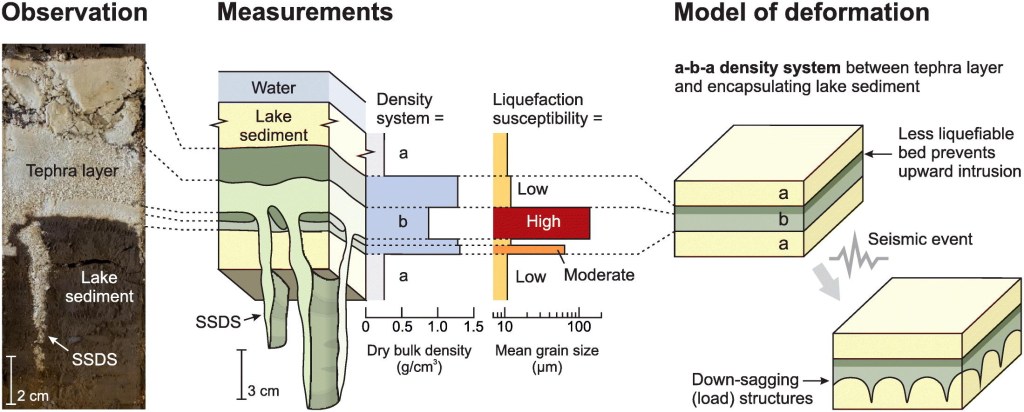
M.Sc. student Richard Melchert has worked for the Tephra-Seismites group since mid 2021 and assisted with lake coring, sediment description, and other laboratory work. In his recently submitted dissertation entitled “Sedimentology and characterisation of soft-sediment deformation structures within lacustrine successions in 20,400-year-old Lake Rotoroa, Hamilton, New Zealand”, he studied liquefaction structures in Lake Rotoroa, which provide evidence for earthquake activity since the formation of the lake around 20,000 years ago.
Richard used a range of techniques, including X-ray computed tomography (CT), ground penetrating radar (GPR), and grain size analyses. The CT scans enabled him to visualise the liquefaction structures in three dimensions (see figures below).
Vertical flame-like dike penetrating through organic lake sediment (removed during the CT data processing). The dike’s source bed is located within the ~20,000-years-old Hinuera Formation, which underlies the present-day lake sediments. Five dikes penetrating downwards from a volcanic ash (tephra) layer, having been deposited ~15,600 years ago. The occurrence of these dikes suggest earthquake activity must have happened after the deposition of this tephra layer.Richard before handing in his dissertation.
Contact Info
Dr Tehnuka Ilanko
School of Science
University of Waikato
Private Bag 3105
New Zealand
+64 7838 4845
tehnuka.ilanko@waikato.ac.nz